
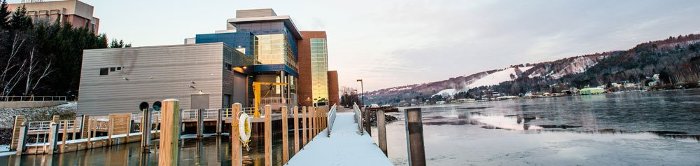
Explore this collection of historic lakeshore imagery gathered by the Geospatial Research Facility, part of Michigan Technological University's Great Lakes Research Center.
These images were used to create the CZMP Coastline Viewer WebApp, a project that supports the Michigan Coastal Zone Management Program's (MCZMP) multi-year Coastal Resilience Strategy. Learn more here.
Submissions from 2021
Aerial Imagery of the Lake Huron Coastline Alcona County Michigan, 1938, Ryan Andrew Williams
Aerial Imagery of the Lake Huron Coastline Alcona County Michigan, 1979, Ryan Andrew Williams
Aerial Imagery of the Lake Huron Coastline Alpena County Michigan, 1938, Ryan Andrew Williams
Aerial Imagery of the Lake Huron Coastline Alpena County Michigan, 1979, Ryan Andrew Williams
Aerial Imagery of the Lake Huron Coastline Arenac County Michigan, 1938, Ryan Andrew Williams
Aerial Imagery of the Lake Huron Coastline Arenac County Michigan, 1979, Ryan Andrew Williams
Aerial Imagery of the Lake Huron Coastline Bay County Michigan, 1938, Ryan Andrew Williams
Aerial Imagery of the Lake Huron Coastline Bay County Michigan, 1979, Ryan Andrew Williams
Aerial Imagery of the Lake Huron Coastline Cheboygan County Michigan, 1938, Ryan Andrew Williams
Aerial Imagery of the Lake Huron Coastline Cheboygan County Michigan, 1979, Ryan Andrew Williams
Aerial Imagery of the Lake Huron Coastline Emmet County Michigan, 1938, Ryan Andrew Williams
Aerial Imagery of the Lake Huron Coastline Emmet County Michigan, 1979, Ryan Andrew Williams
Aerial Imagery of the Lake Huron Coastline Huron County Michigan, 1938, Ryan Andrew Williams
Aerial Imagery of the Lake Huron Coastline Huron County Michigan, 1979, Ryan Andrew Williams
Aerial Imagery of the Lake Huron Coastline Iosco County Michigan, 1938, Ryan Andrew Williams
Aerial Imagery of the Lake Huron Coastline Iosco County Michigan, 1979, Ryan Andrew Williams
Aerial Imagery of the Lake Huron Coastline Macomb County Michigan, 1938, Ryan Andrew Williams
Aerial Imagery of the Lake Huron Coastline Macomb County Michigan, 1979, Ryan Andrew Williams
Aerial Imagery of the Lake Huron Coastline Presque Isle County Michigan, 1938, Ryan Andrew Williams
Aerial Imagery of the Lake Huron Coastline Presque Isle County Michigan, 1979, Ryan Andrew Williams
Aerial Imagery of the Lake Huron Coastline Sanilac County Michigan, 1938, Ryan Andrew Williams
Aerial Imagery of the Lake Huron Coastline Sanilac County Michigan, 1979, Ryan Andrew Williams
Aerial Imagery of the Lake Huron Coastline St. Clair County Michigan, 1938, Ryan Andrew Williams
Aerial Imagery of the Lake Huron Coastline St. Clair County Michigan, 1979, Ryan Andrew Williams
Aerial Imagery of the Lake Huron Coastline Tuscola County Michigan, 1938, Ryan Andrew Williams
Aerial Imagery of the Lake Huron Coastline Tuscola County Michigan, 1979, Ryan Andrew Williams
Aerial Imagery of the Lake Huron Coastline Wayne County Michigan, 1979, Ryan Andrew Williams
Aerial Imagery of the Lake Michigan Coastline Allegan County Michigan, 1938, Ryan Andrew Williams
Aerial Imagery of the Lake Michigan Coastline Allegan County Michigan, 1980, Ryan Andrew Williams
Aerial Imagery of the Lake Michigan Coastline Antrim County Michigan, 1938, Ryan Andrew Williams
Aerial Imagery of the Lake Michigan Coastline Antrim County Michigan, 1980, Ryan Andrew Williams
Aerial Imagery of the Lake Michigan Coastline Benzie County Michigan, 1938, Ryan Andrew Williams
Aerial Imagery of the Lake Michigan Coastline Benzie County Michigan, 1980, Ryan Andrew Williams
Aerial Imagery of the Lake Michigan Coastline Berrien County Michigan, 1938, Ryan Andrew Williams
Aerial Imagery of the Lake Michigan Coastline Berrien County Michigan, 1980, Ryan Andrew Williams
Aerial Imagery of the Lake Michigan Coastline Charlevoix County Michigan, 1938, Ryan Andrew Williams
Aerial Imagery of the Lake Michigan Coastline Charlevoix County Michigan, 1980, Ryan Andrew Williams
Aerial Imagery of the Lake Michigan Coastline Cheboygan County Michigan, 1938, Ryan Andrew Williams
Aerial Imagery of the Lake Michigan Coastline Cheboygan County Michigan, 1980, Ryan Andrew Williams
Aerial Imagery of the Lake Michigan Coastline Emmet County Michigan, 1938, Ryan Andrew Williams
Aerial Imagery of the Lake Michigan Coastline Emmet County Michigan, 1980, Ryan Andrew Williams
Aerial Imagery of the Lake Michigan Coastline Emmet County Michigan, 1980, Ryan Andrew Williams
Aerial Imagery of the Lake Michigan Coastline Grand Traverse County Michigan, 1938, Ryan Andrew Williams
Aerial Imagery of the Lake Michigan Coastline Grand Traverse County Michigan, 1980, Ryan Andrew Williams
Aerial Imagery of the Lake Michigan Coastline Leelanau County Michigan, 1938, Ryan Andrew Williams
Aerial Imagery of the Lake Michigan Coastline Leelanau County Michigan, 1980, Ryan Andrew Williams
Aerial Imagery of the Lake Michigan Coastline Leelanau County Michigan, 1980, Ryan Andrew Williams
Aerial Imagery of the Lake Michigan Coastline Leelanau County Michigan, 1980, Ryan Andrew Williams
Aerial Imagery of the Lake Michigan Coastline Manistee County Michigan, 1938, Ryan Andrew Williams
Aerial Imagery of the Lake Michigan Coastline Manistee County Michigan, 1980, Ryan Andrew Williams
Aerial Imagery of the Lake Michigan Coastline Mason County Michigan, 1938, Ryan Andrew Williams
Aerial Imagery of the Lake Michigan Coastline Mason County Michigan, 1980, Ryan Andrew Williams
Aerial Imagery of the Lake Michigan Coastline Muskegon County Michigan, 1938, Ryan Andrew Williams
Aerial Imagery of the Lake Michigan Coastline Muskegon County Michigan, 1980, Ryan Andrew Williams
Aerial Imagery of the Lake Michigan Coastline Oceana County Michigan, 1938, Ryan Andrew Williams
Aerial Imagery of the Lake Michigan Coastline Oceana County Michigan, 1980, Ryan Andrew Williams
Aerial Imagery of the Lake Michigan Coastline Ottawa County Michigan, 1938, Ryan Andrew Williams
Aerial Imagery of the Lake Michigan Coastline Ottawa County Michigan, 1980, Ryan Andrew Williams
Aerial Imagery of the Lake Michigan Coastline Van Buren County Michigan, 1938, Ryan Andrew Williams
Aerial Imagery of the Lake Michigan Coastline Van Buren County Michigan, 1980, Ryan Andrew Williams
Aerial Imagery of the Lake Superior Coastline Alger County Michigan, 1938, Ryan Andrew Williams
Aerial Imagery of the Lake Superior Coastline Alger County Michigan, 1980, Ryan Andrew Williams
Aerial Imagery of the Lake Superior Coastline Baraga County Michigan, 1938, Ryan Andrew Williams
Aerial Imagery of the Lake Superior Coastline Baraga County Michigan, 1980, Ryan Andrew Williams
Aerial Imagery of the Lake Superior Coastline Chippewa County Michigan, 1938, Ryan Andrew Williams
Aerial Imagery of the Lake Superior Coastline Chippewa County Michigan, 1980, Ryan Andrew Williams
Aerial Imagery of the Lake Superior Coastline Houghton County Michigan, 1938, Ryan Andrew Williams
Aerial Imagery of the Lake Superior Coastline Houghton County Michigan, 1980, Ryan Andrew Williams
Aerial Imagery of the Lake Superior Coastline Keweenaw County Michigan, 1938, Ryan Andrew Williams
Aerial Imagery of the Lake Superior Coastline Keweenaw County Michigan, 1980, Ryan Andrew Williams
Aerial Imagery of the Lake Superior Coastline Marquette County Michigan, 1938, Ryan Andrew Williams
Aerial Imagery of the Lake Superior Coastline Marquette County Michigan, 1980, Ryan Andrew Williams
Aerial Imagery of the Lake Superior Coastline Ontonagon County Michigan, 1938, Ryan Andrew Williams
Aerial Imagery of the Lake Superior Coastline Ontonagon County Michigan, 1980, Ryan Andrew Williams